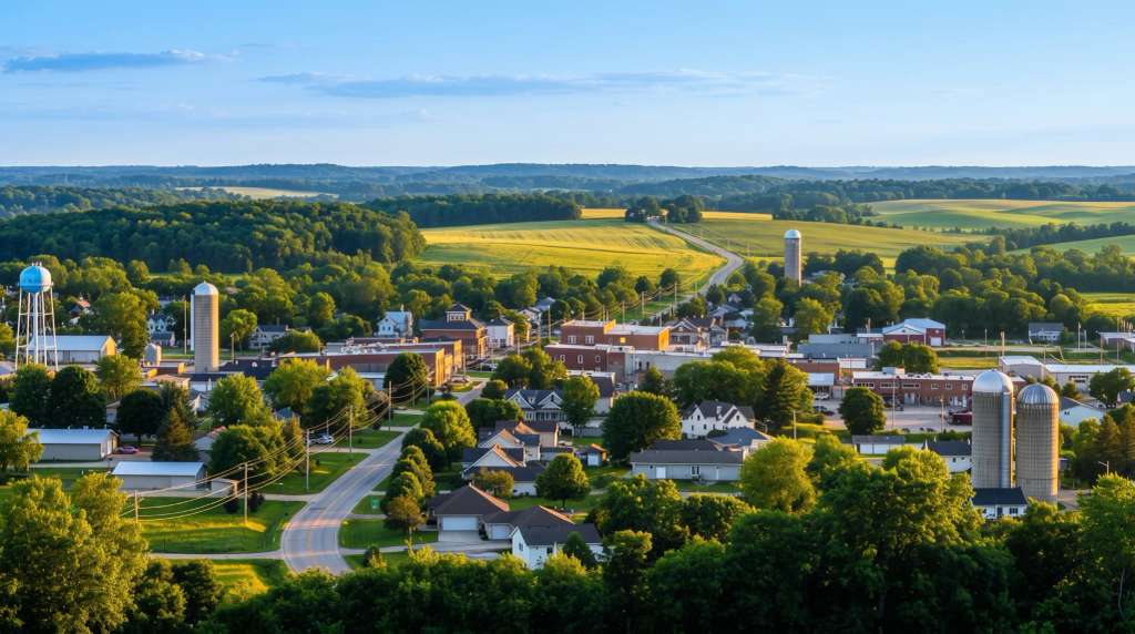
Most people who come to Slinger for the outdoors end up on the same short stretch of trail without realising how much sits within a few minutes of it. The Ice Age Trail Slinger Segment is the one they find, a mostly level walk right through the village, but it is only the start: three short segments thread through and around town, the second-largest cluster of glacial kames in Wisconsin sits just to the north, and a county park layers mountain-bike and disc-golf trails over the hiking. You can put together an easy morning or a full day out here, and this walks through the segments, the trailheads, the parking and what to bring, one piece at a time.
The Ice Age Trail segments near Slinger
Three short segments put the 1,200-mile national scenic trail within reach of the village center, and they are quite different from one another. The trail as a whole traces the terminal moraine of the last glaciation across Wisconsin, which is a formal way of saying it follows the line where the ice stopped and dumped everything it was carrying. Around Slinger that line left behind some of the best glacial landforms on the whole route.
The Slinger Segment itself runs about 2.1 miles, mostly level and partly along town streets and sidewalks, which makes it a gentle introduction rather than a backcountry hike. It starts near the CTH-CC and STH-60 intersection and you can park at Slinger Community Park and pick it up from there. There are no reliable water sources along it, so carry your own even on the short one.
Just south, the Pike Lake Segment is the more scenic of the set: a 3.2-mile walk through the Kettle Moraine State Forest's Pike Lake Unit that climbs to an observation tower on top of Powder Hill, one of the highest points around, with a view over the whole moraine. It gains a little over 220 feet, enough to feel it on the tower climb, and it rewards the effort. One thing to know before you go: a Wisconsin state-park sticker is required to park at the Pike Lake Unit, unlike the other two segments here. If you have young children, the short spur from the Pike Lake side up to the Powder Hill tower is about half a mile and gets you the view without the full segment.
North of town, the Cedar Lakes Segment runs 2.8 miles through the Polk Kames, covered in its own section below, and the longer Holy Hill Segment beyond it climbs 6.9 miles through hilly terrain and deep kettles to the kame the Holy Hill basilica sits on. The Holy Hill stretch is the one locals name first for fall color.
The Polk Kames
The Polk Kames are the reason to make a special trip. They are the second-largest cluster of kames in the state, the steep conical hills of sand and gravel that meltwater dropped through holes in the retreating glacier, and some of them tower close to 100 feet above the trail. The path here loops through hardwood forest, old oak, sugar maple, white birch and beech, and open farm field, so you walk among the landforms rather than just past them.
The trailhead lot sits on the south side of County Highway NN, about a quarter mile east of the intersection with State Highway 144, just off I-41 at Exit 66. There is no entry fee and no state sticker required here, which is the practical difference from Pike Lake. In the interior is a 0.8-mile white-blazed Kame Loop that curves right around one of the prominent kames, and the main loop suits both a slow wander and a brisker walk, with benches placed for resting along the way. It is open daily, and early morning is the quiet time and the best for wildlife.
Two honest cautions. Seasonal hunting is permitted on the property except within 100 yards of the Ice Age Trail itself, so blaze orange is worth wearing here in season. And there are no restrooms at the trailhead, so plan around that. In spring the forest floor puts on a scattered show of woodland wildflowers, trillium, wood anemone, mayapple, violets and jack-in-the-pulpit among them, which is worth timing a visit for if you like that sort of thing.
What the glacier actually left behind
It helps to know what you are looking at, because the landforms around Slinger are close to a textbook set. A kame is a conical hill of sand and gravel, dropped where meltwater poured through a hole in the ice and piled its load in one spot. A kettle is the opposite move: a bowl-shaped depression left when a buried block of ice finally melted and the ground above it collapsed, and many of the kettles across this region are now small lakes. The whole Kettle Moraine is named for exactly this pairing of kames and kettles sitting side by side.
The Polk Kames are one of the best places on the North Coast of this trail to see the kames stacked close together, and once you have the vocabulary you start noticing the shapes everywhere on the drive in. It is the kind of thing that makes a walk here more than just a walk.
Heritage Trails County Park
For riding rather than walking, Heritage Trails County Park is the spot. It is an expansive park with a mountain-bike trail system that runs from beginner-friendly flow trails to more technical sections, and it welcomes hikers and disc golfers on the same ground, so a mixed group can each do their own thing without splitting up entirely.
Cyclists get thoughtful touches like bike repair stands and hoses, and the trails have a reputation for being exceptionally well maintained, which draws riders from out of town alongside locals. It works year-round, with the trails taking on a different character once the snow arrives and the fat-bike and snowshoe crowd moves in.
Trailheads, parking and what to bring
A few practicalities tie the day together, because the three segments do not share a parking rule. The Slinger Segment parks at Community Park, with roadside parking on Glassgo Drive as backup, and it is free. The Pike Lake Segment needs a state-park sticker at the Pike Lake Unit. The Polk Kames has its own free trailhead lot on County Highway NN. There is no parking along Cedar Creek Road, so do not plan on it.
Beyond that: none of these segments has reliable drinking water at the trailhead, so bring your own. Dogs are welcome on leash. Blaze orange is worth wearing during Wisconsin hunting seasons on the stretches that pass through the state forest and the Polk Kames property. The best months are roughly April through October, though the trails stay walkable in winter with traction underfoot, and some north-facing sides of the kames hold snow later into the season than you would expect. There are no restrooms at the Polk Kames trailhead, and only seasonal facilities at the Pike Lake Unit.
After the trail: food and a drink
When you are done, the town is right there. The Pub on Arthur Road is the closest spot to the Polk Kames for a post-hike beer, the kind of small neighborhood tavern that suits muddy boots.
If you would rather sit with a glass of something, Aspen Sky is a winery and distillery on the edge of town with a modern-rustic tasting room and big windows, an easy landing after a morning outside.
For a proper meal afterward, from a Friday fish fry to breakfast the next morning, the town's taverns and cafes have the range. The trail also slots easily into a broader day of sights and stops around Slinger.
Keep going: the West Bend segment
If you are chasing more of the Ice Age Trail once you have worked through the Slinger segments, the next good stretch north is in West Bend, about 8 kilometres away. Hiking the Ice Age Trail in West Bend is the hillier, longer sequel, climbing through the Glacial Blue Hills and Ridge Run Park on a 6.5-mile segment.
Frequently asked questions
Published August 18, 2026